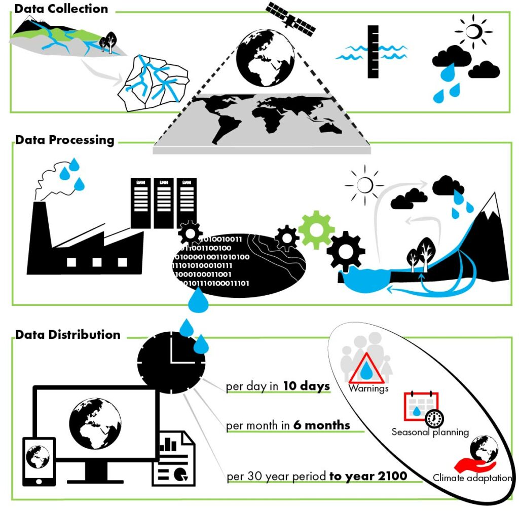
The numerical water predictions are produced by a chain of calculation steps using many databases, the hydrological model code HYPE and various scripts for pre- and post-processing of variables. When the production is operational, the calculations are repeated with certain intervals using a scheduler. The production chain can be summarized as follows (Fig. 1):

First, data for the model is collected and the model is set up based on physiographical characteristics of the landscape, which are compiled in model input files. Normally the spatial resolution is delineated (by a grid or) for catchments defined by topography, which are linked according to the direction of river flow by using the tool WHIST. For large geographical domains, temperature and precipitation from meteorological or climate models needs to be bias adjusted to fit observations at local scale before they are included as model input files for hydrological predictions.
Second, when executing the model, the calculations are forced at each time-step by reading the data file of temperature and precipitation for each catchment (or grid). For forecasts, the calculations are repeated every day or every hour (depending on time step) when new data from the meteorological forecast is available to force the model. The forecast starts with a model state, which is saved from the previous time-step, or is initialized by running a longer historical period ending up in a new model state before the forecast period. The forecast period is normally 1-10 days for short-term forecasts, or 1 month for seasonal forecasts. For predictions of climate chamge on water resources, the model is normally run at a daily time-step but post-processed for 30 year time slots, to exclude natural variability in weather from climate trends. The HYPE model results are evaluated against observations for historical periods to examine model performance.
Third, the results are statistically compiled and/or merged with other data before being distributed to different water and climate services. Historical data may be compiled into various flow signatures of interest to the user. Short-term forecasts may be provided directly or used to calculate warnings by comparing the results for coming days with thresholds for warning levels. Seasonal forecasts have less skills and are used to calculate probabilities of higher or lower flow than normal. Climate change impacts are often provided as Climate Impacts Indicators and visualized in maps and graphs or used in detailed tailored climate assessments for specific customers.
